
Midlothian · Chesterfield County · FAA Part 107 Certified
Drone Photography in Midlothian, VA
Air and ground, one visit, one gallery.
Midlothian is a bigger-lot market, and that changes what the camera has to do. Brandermill and Woodlake sell on water and tree cover. Hallsley and Salisbury sell on architecture and lot shape. Acreage out past Route 288 sells on boundary, access, and what the land actually does. All three of those are aerial problems first and interior problems second, which is the opposite of a city listing.
What matters here
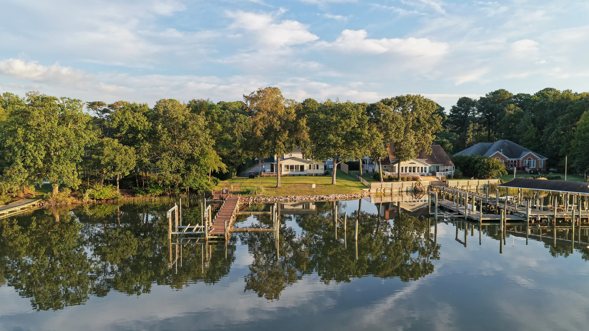
- Water and treeline, read properly. Brandermill and Woodlake frontage on Swift Creek Reservoir is the asset. An aerial at the right time of day shows the water, the dock, and the tree canopy as one picture instead of three disconnected snapshots.
- Acreage and land tours. Lots past Route 288 run large. We fly property overviews and stitched orthomosaic maps so a buyer can see the whole parcel, the access, the clearings, and the boundary relationship in one frame. See land and mapping.
- Architecture-forward listings. Hallsley and Salisbury homes are designed to be looked at. Low aerials and ground stills at matched exposure show the elevation the architect intended.
- Equestrian, farm, and large-parcel work. Barns, paddocks, fence lines, and outbuildings photograph from the air in a way a ground shot simply cannot reproduce.
Coverage
Midlothian sits in Chesterfield County southwest of Richmond, along the Midlothian Turnpike and Route 288 corridors. We cover it as a core service area with no travel surcharge, along with Brandermill, Woodlake, Hallsley, Salisbury, Bon Air, Chester, and the wider Chesterfield County area.
What you get
- Aerial stills and video. Flown by an FAA Part 107 certified remote pilot, airspace cleared per address.
- Full-frame ground photography. Interiors and exteriors shot at 45.7MP with professional lighting, not a phone and a prayer.
- One delivery. A single private download gallery, delivered in days rather than weeks.
- A flat quote up front. Confirmed before the shoot. No hourly billing, no surprise add-ons.
Also serving nearby: Chesterfield and Bon Air · Short Pump · Land and mapping
FAQ
Questions from Midlothian clients
Do you cover acreage outside the subdivisions?
Yes, and it is some of our best work. Large parcels are where aerial earns its keep. We fly property overviews, acreage tours, and stitched overhead maps. We are not licensed surveyors, so if you need stamped survey-grade measurements we will refer you to a licensed surveying partner rather than overpromise.
Can you shoot the reservoir frontage from the water side?
We fly it from the air, which gets you the angle a boat cannot: the house, the dock, the shoreline, and the tree cover in a single composed frame. Flight stays clear of people and vessels.
Is Midlothian inside your service area?
Yes. Chesterfield County is core coverage with no travel surcharge.
Do you offer thermal work out here?
Yes. Thermal roof and building scans on request, and thermal search and recovery for downed game and lost pets across Chesterfield, Powhatan, and Amelia. See thermal recovery.
Midlothian · Chesterfield County
Shooting in Midlothian? Get a same-day quote.
Veteran-owned, FAA Part 107 certified, fully insured. Airspace checked before we quote. Air and ground in one visit.